Baxter May Be a Small Town, But We Have Big Aspirations. Take a Look at What We Are Trying to Accomplish:
• Station Street Corridor (Boards 7a and 7b)
• Chichaqua Valley Trailhead Improvements
About the Iowa Living Roadways Community Visioning Program
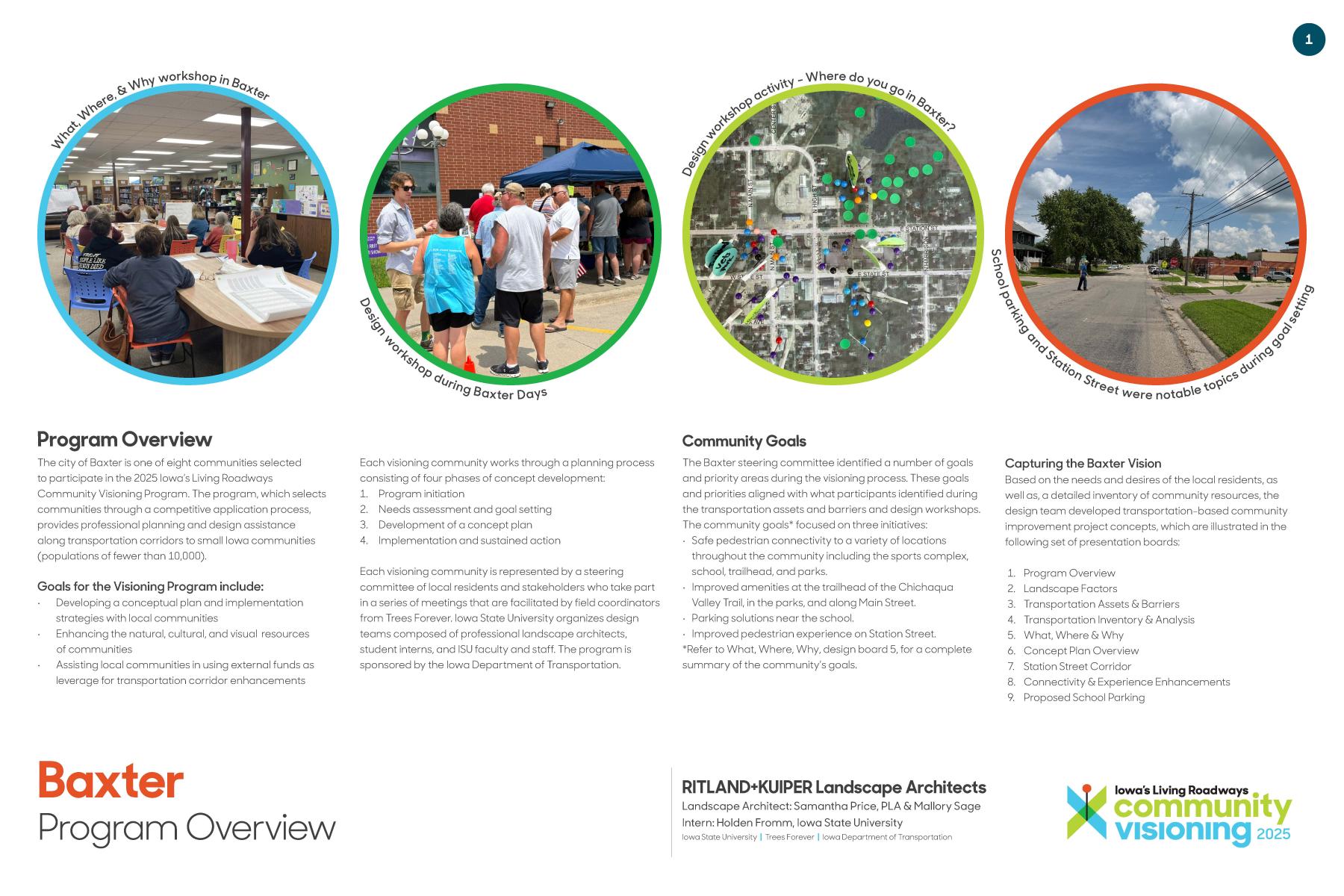
Baxter was selected as one of eight Iowa communities to participate in the 2025 Iowa Living Roadways Community Visioning Program. The program helps small towns implement transportation improvements that enhance safety, accessibility, and quality of life. Baxter residents, city staff, and partner organizations worked closely with Iowa State University, Trees Forever, and the Iowa Department of Transportation throughout the project.
The visioning process moved through four stages. These included initiation, a detailed needs assessment, creation of concept plans, and a final implementation phase. The Baxter steering committee, made up of local stakeholders, guided the work and provided feedback at each meeting.
Community Priorities
Through surveys, focus groups, and design workshops, several priorities stood out. Residents want safer sidewalks and crossings, better pedestrian routes to the school, sports complex, and trailhead, and a more inviting look for Main Street. Many noted difficulties with school parking and traffic. Others described challenges at the post office and along Station Street where pedestrians often walk in the street due to sidewalk gaps.
These findings shaped the design concepts presented in the final boards.
Understanding Current Conditions
Baxter’s transportation network includes two Farm-to-Market routes, a busy school campus, and a trailhead serving local residents and visitors. Several areas show aging infrastructure and safety concerns. Sidewalks are inconsistent in width or condition. Crosswalks are limited in several locations. Station Street is heavily used by students walking between the school and the sports complex, yet lighting and crossings are limited.
Downtown Baxter also faces pressure from angled parking near the post office and limited visibility for both drivers and pedestrians. Flooding concerns also surfaced, since the community sits near Turkey Creek and has a high water table. Geise Park and new planned developments play a role in future stormwater management and trail connections.
How the Concepts Address Community Needs
The design team developed a set of improvements that directly respond to community feedback.
Station Street Corridor
Station Street is reimagined as a safe pedestrian corridor that links the school, sports complex, downtown, trailhead, and parks. Improvements include an eight-foot trail where space allows, upgraded sidewalks, pedestrian lighting, colored concrete intersections, and highly visible crosswalks. Benches and new tree plantings add comfort and shade.
School Parking Improvements
Because the school campus is landlocked and lacks adequate parking, the steering committee supported adding a 132-stall lot on the south side. This reduces congestion on nearby streets and creates safer routes for students. Additional recommendations include removing front-in parking in Giese Park and designating bus areas that allow clearer pedestrian movement.
Trailhead and Veterans Memorial Enhancements
Residents requested improved amenities at the Chichaqua Valley Trailhead. The concept includes a small shelter with restrooms, updated signage, seating, pollinator plantings, an improved kiosk, and art features. The goal is to create a welcoming place for both residents and trail users entering Baxter.
Main Street Improvements
Main Street reflects Baxter’s character but needs targeted safety upgrades. Bump-outs reduce crossing distances, additional crosswalk improvements help visibility, and more handicapped parking near the post office supports daily users. New trees, pedestrian lights, benches, and planters improve the appearance and comfort of the business district.
Project Materials
The design team developed a set of improvements that directly respond to community feedback.
The following documents summarize the full Baxter Community Visioning project. They include transportation analysis, community feedback, final design boards, and feasibility notes used to develop the concepts.
Available Downloads:
• Program Overview
• Transportation Inventory and Analysis
• Station Street Corridor (Boards 7a and 7b)
What Happens Now
Baxter will use the Community Visioning concepts as a guide for long-range planning, including the city’s new comprehensive plan and future capital improvement planning. Several concepts will also support grant applications, school district partnerships, trail development discussions, and coordination with Jasper County on transportation and stormwater improvements.
Community Visioning provides Baxter with a starting point for planning safe routes, improving public spaces, and supporting quality of life as the community continues to grow.